Not built from below
The Caribbean has two quite different kinds of solid ground. The arc of small islands curving from the Virgin Islands to Trinidad is volcanic or coral-capped — built up from the sea floor by subduction and wave action, and young in geological terms. The Greater Antilles work on an entirely different principle. Cuba, Hispaniola, Jamaica and Puerto Rico are not oceanic constructions. They are fragments of continental crust that were once attached to the North American and South American plates, dislocated and rearranged by the movement of the Caribbean Plate over tens of millions of years. The distinction matters for almost everything that follows: their size, their interiors, their rivers, their mineral wealth and the sheer diversity of environments they can support.
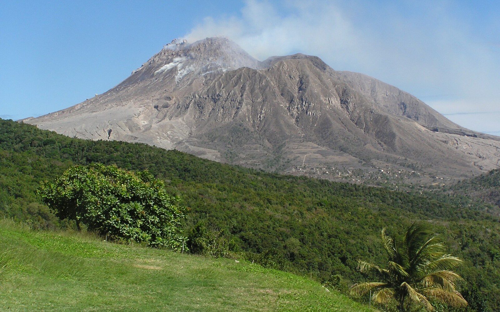
A subduction zone that is still working — The Lesser Antilles are an active arc — Montserrat's Soufrière Hills from 1995 and St Vincent's La Soufrière in 2021 are the recent eruptions, both well documented.
Soufriere Hills · Wikimedia Commons
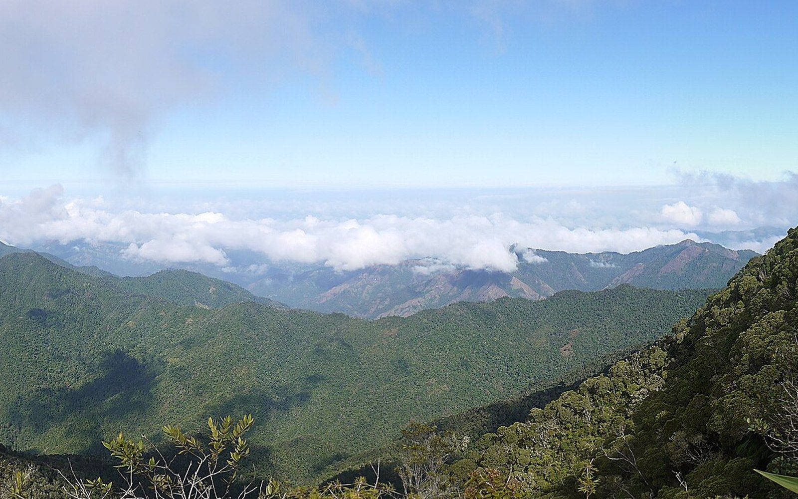
Continental crust is fundamentally thicker and more complex than the oceanic crust that underlies a volcanic island. It carries a full suite of rock types — metamorphic basement, ancient limestones, intrusive granites, deformed sedimentary sequences — rather than the relatively uniform basalt of a volcanic pile. Cuba's Sierra Maestra, Hispaniola's Cordillera Central and Jamaica's Blue Mountains are not volcanoes; they are uplifted, folded and faulted mountain ranges of the kind you find on continents, pushed up by tectonic collisions rather than erupted from a hotspot or a subduction zone. Puerto Rico's interior shows a similarly complex geology: metamorphic and igneous basement rocks that speak to a Cretaceous island arc origin later welded onto the Caribbean Plate and deformed into something structurally more like a small continent than a volcanic island.
The consequences begin with scale. Cuba is the largest island in the Caribbean, stretching around 1,250 kilometres from end to end — long enough that its eastern and western ends have meaningfully different climates, soils and agricultural characters. Hispaniola, shared between Haiti and the Dominican Republic, is the second largest and rises to Pico Duarte at roughly 3,098 metres, the highest point in the entire Caribbean. Jamaica covers around 10,990 square kilometres. Even Puerto Rico, the smallest of the four, is large enough to sustain a mountainous interior — the Cordillera Central — flanked by distinct coastal plains.
What size and relief actually produce
Height produces rainfall gradients that flat islands simply cannot achieve. The Greater Antilles intercept trade-wind moisture against their mountain ranges, wringing out orographic rain — rainfall driven by air being forced upward over terrain — on windward slopes while leaving leeward rain shadows comparatively dry. This gives the large islands genuine river systems: the Artibonite in Hispaniola, the Cauto in Cuba, the Black River in Jamaica. Rivers of this kind were the prerequisite for plantation irrigation on a scale impossible in the Eastern Caribbean, and they remain the basis for hydroelectric generation, municipal water supply and freshwater fisheries. The contrast with the limestone islands of the Lesser Antilles or the flat carbonate platform of the Bahamas — islands that have to manufacture their water through desalination — is fundamental.
The arc of small islands curving from the Virgin Islands to Trinidad is volcanic or coral-capped — built up from the sea floor by subduction and wave action, and young in geological terms.
The geological complexity of continental fragments also means mineral deposits of a kind volcanic islands rarely host. Jamaica's bauxite deposits, the aluminium ore that made the island one of the world's significant producers through much of the twentieth century, are derived from the deep weathering of ancient limestone over continental basement — a geological circumstance unavailable on a volcanic island a million years old. Cuba's nickel and cobalt deposits at Moa in the east are hosted in ophiolite sequences: slices of ancient ocean floor scraped onto the continental fragment during its tectonic history. Neither resource would exist in an arc island built on fresh oceanic basalt.
Soil depth and variety follow the same logic. Where an island like Montserrat or St Lucia sits on relatively young volcanic or marine sedimentary rock, soil profiles are thin and often interrupted by steep slopes. The Greater Antilles have had far longer for deep weathering to produce lateritic and alluvial soils across broad valley floors. Cuba's red ferrallitic soils in Las Villas and the rich alluvial valley floors of Hispaniola supported the sugar monoculture that the plantation economy imposed across the region; the deep soils were a structural advantage even before a single cane stalk was planted. The social consequences of that agricultural history — who was brought to work those soils and in what numbers — are inseparable from the physical geography.
Hazards that come with the territory
Continental fragments are not immune to Caribbean hazards; in some ways they concentrate them. The boundary between the North American Plate and the Caribbean Plate runs directly through the Greater Antilles, making the region seismically active in a way that the volcanic arc, though tectonically dynamic, is not. The Enriquillo–Plantain Garden fault zone cuts across southern Hispaniola and Jamaica; it was the source of the catastrophic January 2010 earthquake that destroyed much of Port-au-Prince and killed an estimated 160,000 people or more. Jamaica has its own documented earthquake history, including a 1692 event that destroyed the city of Port Royal. Puerto Rico sits near the intersection of the Puerto Rico Trench — the deepest point in the Atlantic, at over 8,300 metres below sea level — and a complex of active faults that produced a damaging magnitude 6.4 earthquake in January 2020.
The mountains that generate orographic rainfall also concentrate hurricane damage when storms make landfall. A storm passing over flat terrain loses less energy to friction than one that has to climb and descend mountain ranges, but the mountains themselves funnel rainfall into river valleys: flooding and landslides in the uplands of Hispaniola and Jamaica during major hurricanes repeatedly cause casualties inland, away from the coastal surge that dominates the damage narrative. The landscape that makes the islands productive is also the landscape that amplifies certain risks.
What the Greater Antilles are not — and this matters for any honest account of the region — is a single category. Cuba's structural geology differs significantly from Puerto Rico's, Jamaica's bauxite geology from Hispaniola's Pico Duarte. What they share is continental parentage: the deep crust, the structural complexity, the rivers, the mineral wealth and the sheer space that came with being detached pieces of something much larger, rather than islands that grew from the ocean floor upward. That origin made them the demographic and economic centres of the colonial Caribbean, and it still shapes what they can and cannot support.